Common Functionality
Laser : Demolition of Laser Data : Create Demolition Package
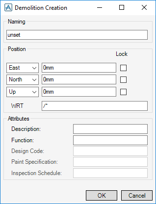
The Demolition Creation window allows you to define the general properties of the demolition package.
|
Input a value in the field to modify the name. If the name value is unset, the demolition package name is inherited from the owning element.
|
|
|
The direction can be defined in East, West, North, South, Up and Down directions using the drop-down lists.
Select the Lock check box to lock the selected direction.
You are prompted to Pick Position (Distance [0]) Snap :
The Positioning Control window displays by default, the Laser Data filter must be selected to pick a position within the laser survey. Refer to Positioning Control for further information.
|
|
Click OK to create the demolition package or Cancel to discard any changes and close the Demolition Creation window. By default, the Demolition Laser Wizard window displays. Refer to Demolition Laser Wizard for further information.
If only one laser survey is displayed in the 3D view when the demolition package is created, the Demolition Laser Wizard window displays asking you to confirm the laser survey to be referenced.
Click Yes to associate the laser survey with the new demolition package.
Click No to associate the laser survey with an alternative demolition package. The Select survey to reference window displays.
|
Note:
|
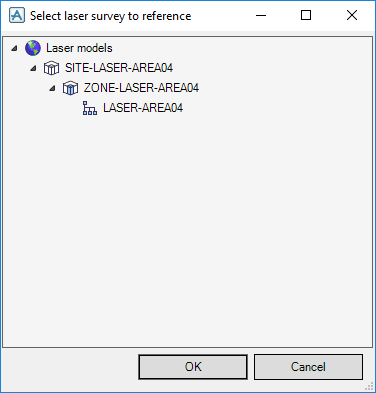
The Select laser survey to reference window also displays if a laser survey is not displayed in the 3D view when the demolition package is created.
|
The Select laser survey to reference window displays all laser surveys that are available for the current project.
Click OK to associate the laser survey with the demolition package or Cancel to discard any changes and close the Select laser survey to reference window.


